The Trip... Journey to Angels Landing
July 8, 2014 New Milford, PA to Morgantown West Virginia.
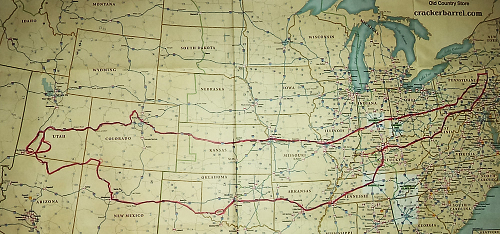
This was the start of a 5,697 mile motorcycle adventure. Destination and goal: Climb 1,488-foot high Angels Landing - a giant rock monolith in the middle of Zion National Park, Utah, have fun, enjoy the ride, and see new places along the way. It will cover 16 states. I took a lot of pictures once I got out west.
I rode I 81 south to Hagerstown, MD, then I 70 and I 68 west. I waited out a thunderstorm in the West Virginia welcome center, then donned raingear before calling it a day in Morgantown, WV. Route 68 was very pretty and scenic but the wind was bothersome as I rode west. Traffic was light with very few trucks and speed limit was 70 mph.
July 9 Morgantown West Virginia to Bardstown Kentucky.
I finished West Virginia on 79 south and entered Kentucky where I saw huge chemical plants belonging to Ashland and Dow/Dupont. I got off the interstate and rode rural route 60. The hills became flatter, the scenery varied from huge country estates to ramshackle properties; interesting and beautiful for the most part. In Lexington, at rush hour, I experienced awful heavy traffic until I came to the Blue Grass Parkway. At Bardstown I took a motel room and treated myself to a nice steak dinner at BJ's Steakhouse - I recommend it highly.
July 10 Bardstown Kentucky to Palestine, Arkansas.
Continued on Bluegrass Parkway to Elizabethtown KY, Then I 65 and I 40 to Nashville Tennessee. Traffic was light and scenery was beautiful. I 40 across TN to Memphis, traffic increased and became very heavy - then I hit Arkansas. Due to construction, repeated delays and spending long periods of time PARKED on I 40's very hot pavement (such that it was) I did not enjoy Arkansas at all and will avoid it in the future - even if I 40 is repaved. AR has a zero tolerance on speed - so it advertises, anyway. I grabbed an inexpensive motel room near Palestine AR. 423 miles this day, 1201 miles so far. Temperatures were comfortable, in the 80's.
July 11 Palestine, Arkansas to Shawnee Oklahoma.
West on I 40 with moderate traffic and trucks until the cities of Little Rock and Fort Smith where truck traffic was intense - as one would expect. Arkansas was flat, hot, and humid - temperatures around 100 degrees. Traffic jams on the Interstate due to construction were almost unbearable. I put on my cooling vest to make riding more tolerable. The OKLAHOMA welcome center was very nice. Spent the night at Shawnee, dinner at Cracker Barrel.
July 12 through July 15 Shawnee Oklahoma to Lawton, OK
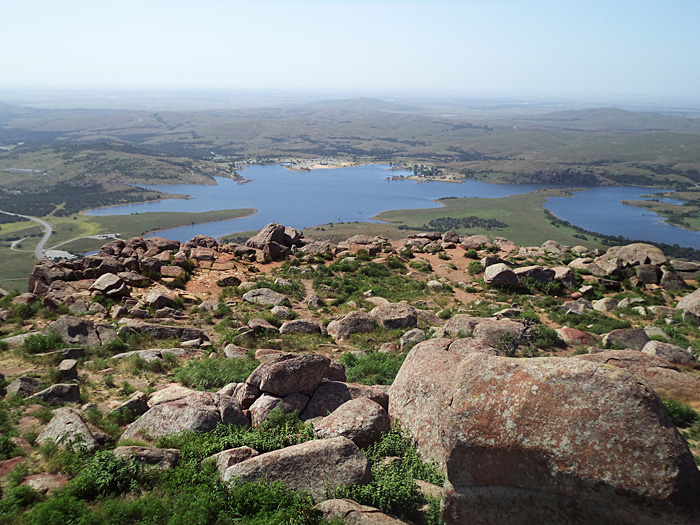
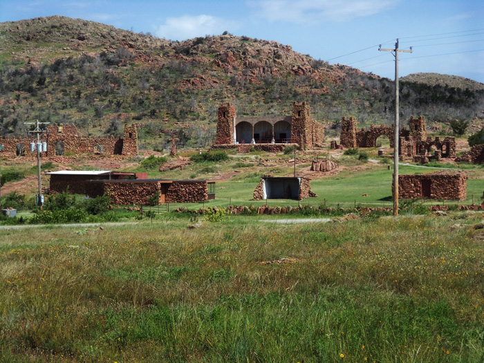
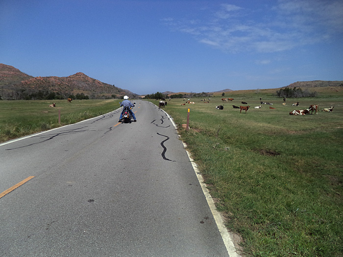
Arrived in LAWTON, OKLAHOMA, 1715 miles so far, to visit my friends Jim and Linda. Their hospitality and the Lawton area, and everything we did, was one of the highlights of the trip. Area cycle rides included Medicine Park and WICHITA Wildlife Preserve, top of Mount Scott, a meal at world famous in-the-middle-of-nowhere MEERS with dinner-plate size steerburgers, the Holy City of Wichita Mountains with it's truly unique architecture , Fort Sill and its ARTILLERY MUSUEM, and Lawton itself. A fun day was spent at a friend's shooting range and the Wind River Harley Davidson dealer we visited in search of a new helmet. (While atop Mt. Scott, I'd seen a Harley helmet that I wanted.) I bought a nice Harley shirt.
I got to ride Jim's yellow Valkyrie - a very nice machine, kept in pristine condition. We were going to go flying in Jim's beautiful, equally pristine plane, but a problem with the fuel kept us grounded.
Lake Lawtonka from 2464 ft summit of Mt. Scott
Holy City of Wichita Mountains
Jim cautiously navigates through free ranging longhorn cattle on Wichita Wildlife Preserve
.
Meers Hamburger Heaven serving up dinner-plate size longhorn steerburgers
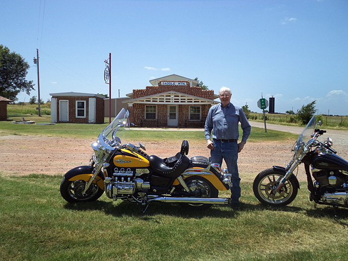
Jim and his Valkyrie at Saddle Mountain.
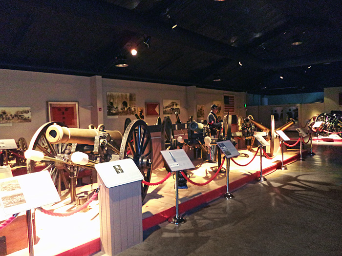
Fort Sill Oklahoma artillery museum
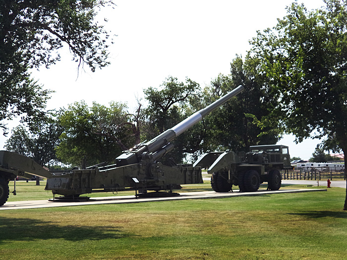
Fort Sill artillery museum Atomic Cannon
two elk browsing roadside trees.
July 16 to Lawton, OK to Moriarity New Mexico
From Lawton OK, took Rt 62 across rest of state into Texas panhandle, stinging COLD RAIN in Texas. Stopped at a convenience store in Memphis TX to warm up - hands were numb and I was shivering. Weather cleared up near Amarillo. Harley dealer there did not have helmet I wanted. Rode ROUTE 66 across Texas into NEW MEXICO. Spent the night in Moriarity, NM. Unusually cool - mid 70's.
July 17 Moriarity NM - to Durango CO.
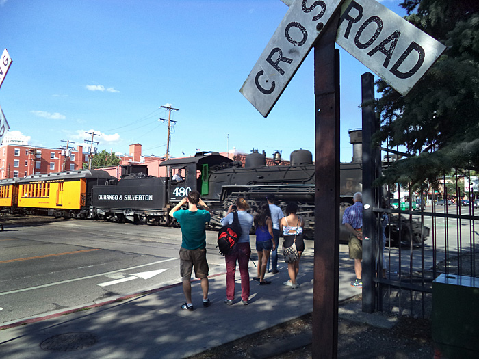
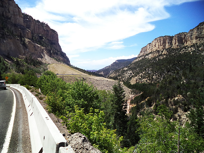
Route 66 and 40 west to Thunderbird Harley Davidson in Albuquerque NM. They helped me locate the helmet I wanted in Durango, Colorado. Took I 25 north to Rt 550, on to Cuba and Bloomfield NM, then into Durango, CO. Crossed the CONTINENTAL DIVIDE. Rt. 550 was a motorcyclist's dream with gorgeous scenery and terrain. On previous trips I rode Rt. 550 from Durango north through Silverton and beyond and it is one of the most exciting, beautiful roadways in America. At Durango, I bought my helmet and got a motel room. Eating at McDonalds when the Durango-Silverton NGRR train came back. Strolled the quaint downtown, bought some shirts for friends back home.
Desert and distant butte on Pueblo of Santa Ana Tamaya Indian Reservation- Rt 550 north of Albuquerque NM
Durango and SIlverton steam train returning from its excursion.
July 18 Durango Colorado to Hurricane Utah
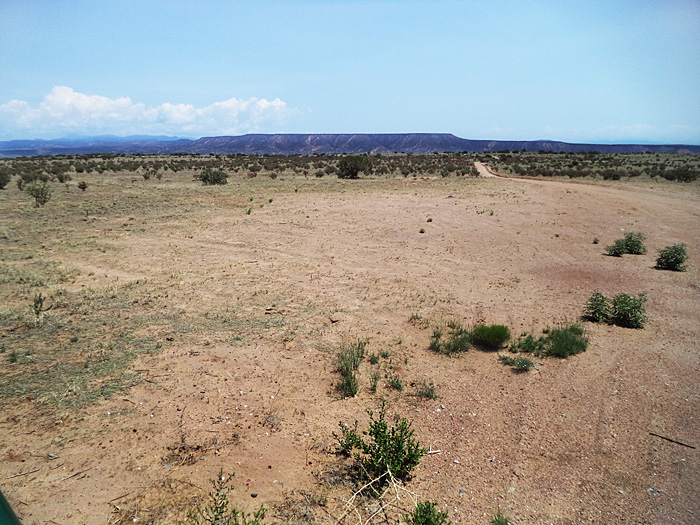
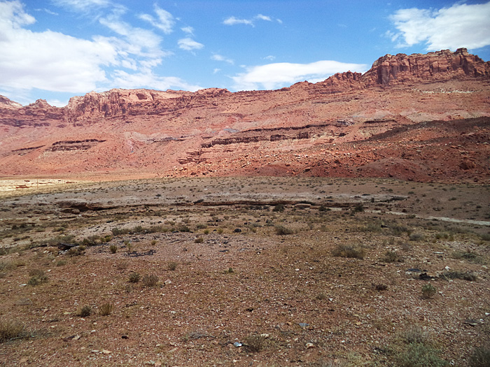
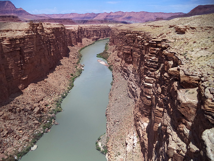
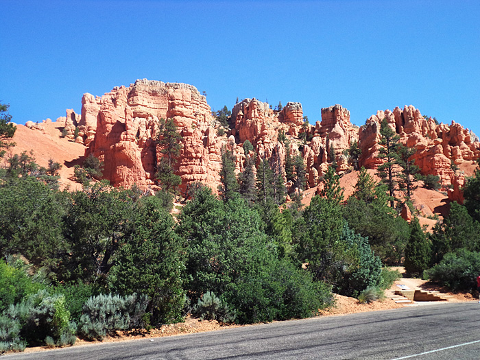
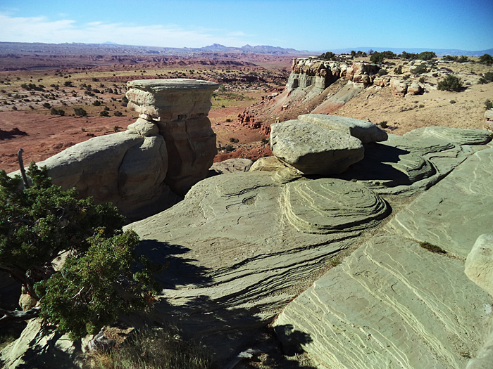
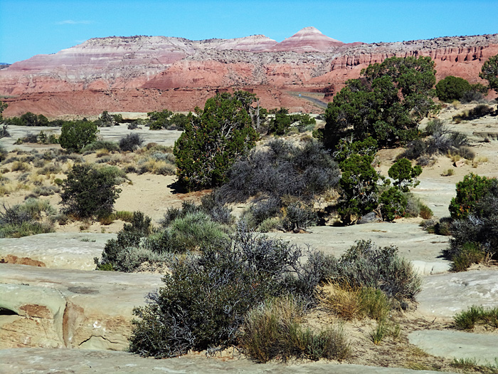
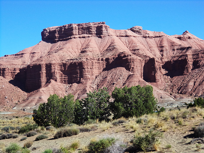
Rode 427 miles today from Durango Colorado to Hurricane Utah. Route 160 W took me to MESA VERDE National Park, then the FOUR CORNERS of CO, NM, AZ, and UT. I continued west on 160 across northern Arizona, a mix of desert and beautiful , colorful mesas and buttes. Awesome scenery. I took 89 north to and across the GRAND CANYON at Navajo Bridge, rode along Vermillion Cliffs and then into Utah, staying in Hurricane for my base of exploration - close to Zion National Park in Utah - my destination. The day started out at 80 degrees - ideal riding temperature - but rose over 110 degrees as the ride progressed across Arizona. The cooling vest was truly a comfort.
Red butte near Navajo National Monument, Arizona
Lees Ferry, Colorado River, Grand Canyon, Arizona.

July 19 Saturday Hurricane UT.to Zion NP and back.
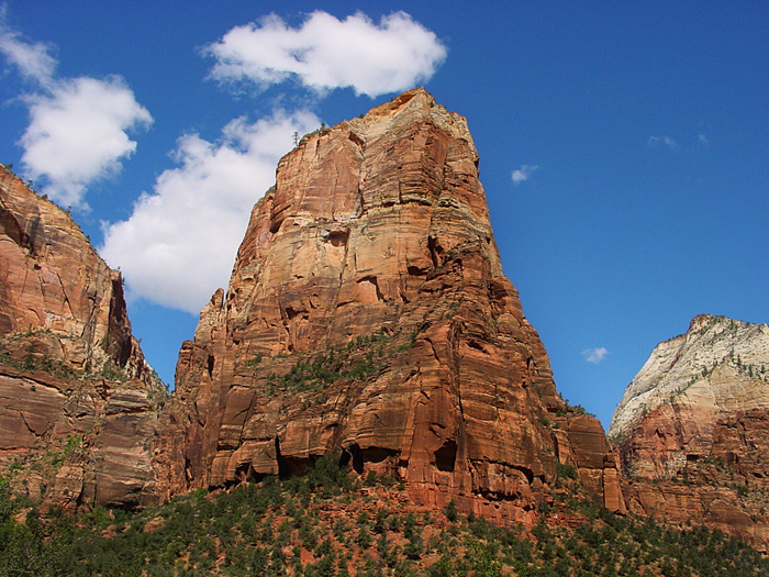
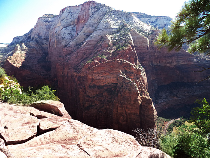
CLIMB ANGEL'S LANDING
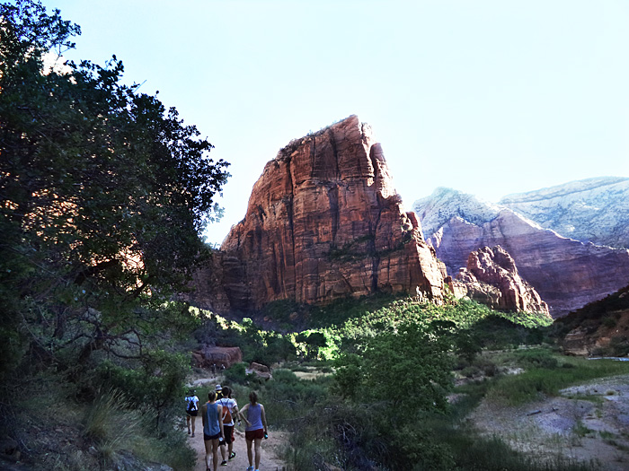
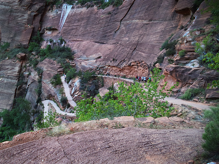
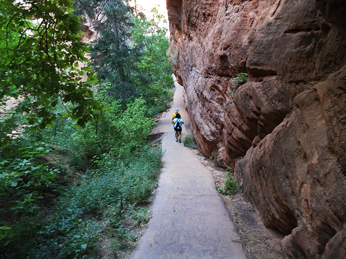
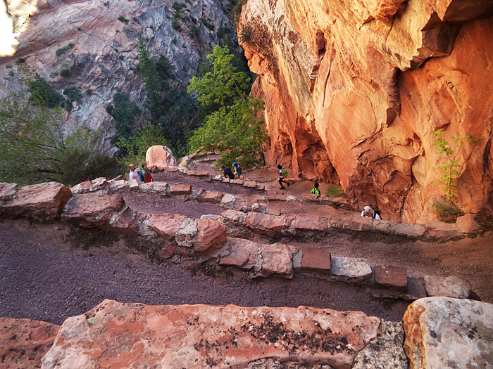
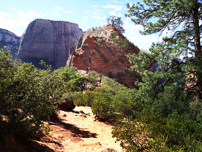
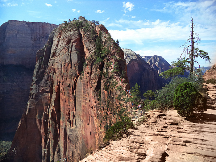
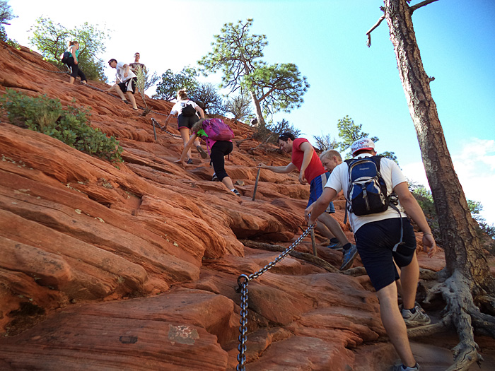
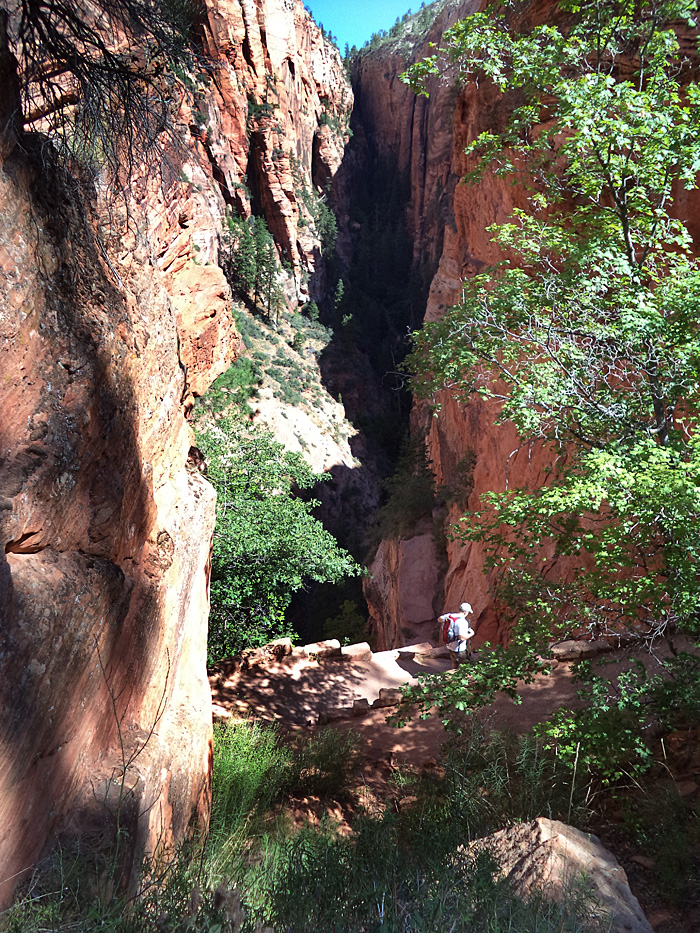
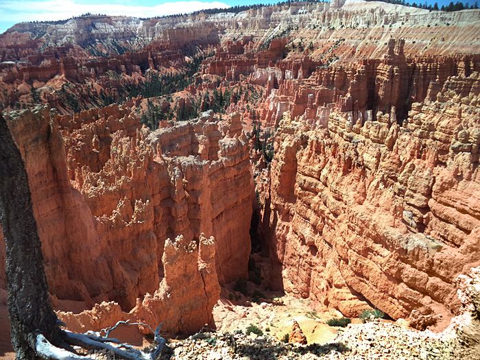
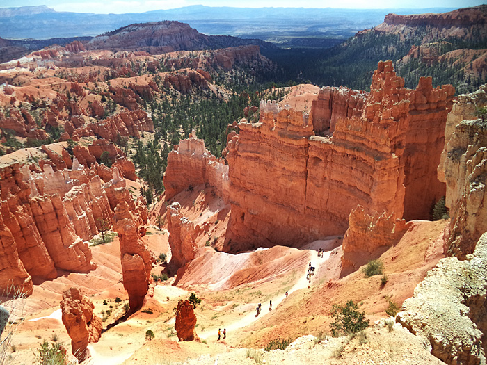
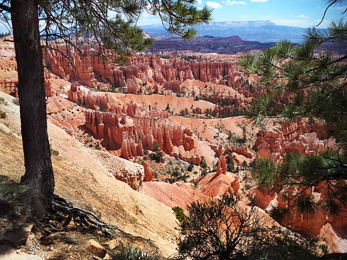
It was only 24 miles from Hurricane to Zion NP. With an early start, it was a cool ride east into the rising sun. I parked the Harley at the first lot and took the free shuttle bus to Angel's Landing trailhead at "The Grotto". The 2-1/2 mile trail up Angels Landing was wide and paved most of the way, rising 1488 feet from Zion Park's floor. There were several places with steep drop-offs on the way up, but the wide trail was comforting. It was steep in spots, flat in others. After the trail climbed to base of Angels Landing, it entered a narrow canyon then ascended the backside of Angels Landing by way of a series of steep switchbacks called Walters Wiggles. Then, with heavy chains for a handhold, it ascended to Scout Lookout. Views were breathtaking - but too much for many as they turned around at this point when they saw the fierce trail ahead of them to the summit. I was intimidated but determined to push on. Thank God for the chains.
The last quarter mile was steep, rugged, very narrow, difficult underfoot with lots of jagged rocks, and treated the climber with truly breathtaking, knee-knocking views off the sides - over 1,000 feet straight down . I made myself focus on the rocks in front of me and avoided looking sideways or down as much as I could. The chains had to be shared with those coming down - and that was not easy as it seemed no one was willing to let go of the chain. The park guide was right - this trail was not for anyone fearful of heights. And I haven't been - up to now. Perhaps the fact this January my friend Frank fell 600 feet to his death in a mountaineering accident on Mount Aconcagua in Argentina was having an effect on me. By the time I reached to top I was shaking and feeling very uneasy, but glad to be there. Then I had to go back down.
Going down Angels Landing was one of the scariest, most frightful things I have ever done in my life. I must have been pumping pure adrenalin through my veins. I shook - my knees knocked and I trembled. Going down there is an awful lot of air in front of you and you cannot avoid looking down. I kept a white knuckle death grip on the chain and proceeded painfully slowly and very carefully. I reached the relative safety of Scout Lookout and sat down for a while - resting, sipping water, and trying to calm myself down. My feet and legs ached from stress, though this was not nearly as strenuous a climb as Mt Katahdin - which I've done three times. But, Mt Katahdin was nowhere near as frightful a climb. I descended Walters Wiggle and the canyon to the base and was grateful that it was over and I would not have to do it again. I could cross Angel's landing off my bucket list.
Approach to 1488 foot high Angels Landing, 2.5 mile trail to top
Ascending the base of Angels Landing
The Canyon (See first photo Angel's Landing - Notch to left is canyon. )
Walters wiggle switchback ascends backside of Angels Landing
End of paved trail. Climb to Scouts Lookout . Climbing gets serious.
The daunting final climb to the summit of Angel's Landing.
Chains to hold onto as you climb higher.
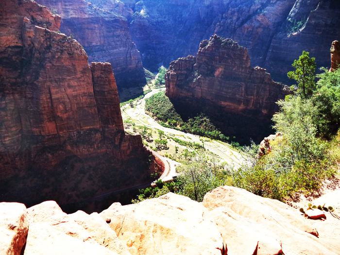
View of park road and Virgin River below.
Zion Park road and valley below.
Walters Wiggle switchback descends into Canyon.
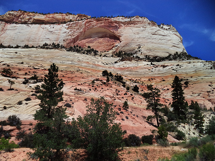
After the Angel's Landing climb I rode around Zion NP - zig-zag up to and through the tunnel at the East entrance to the park. It was a long wait for the tunnel due to its one-way operation. The tunnel can handle 2-way traffic with normal sized vehicles, but big trucks and campers can't make it so they run the tunnel one-way, alternating traffic. Once I got through the tunnel, the line of traffic waiting on the other side (to get in) was two miles long. It was a nice, sunny, busy Saturday.
I took route 9 - a beautiful ride through the multi-colored rock formations and mountains, then rode Route 14 to Cedar City and got on I 15 back towards Hurricane. Speed limit on I 15 was 80 MPH - a thrilling ride as everyone was doing 90MPH. Back at the motel, I lounged by the pool for a while to reflect on the day's activities.
Road through some of the many Multi-colored rock formations near Zion NP.
Dixie National Forest north of Zion NP.
Utah Route 14 above Zion NP.
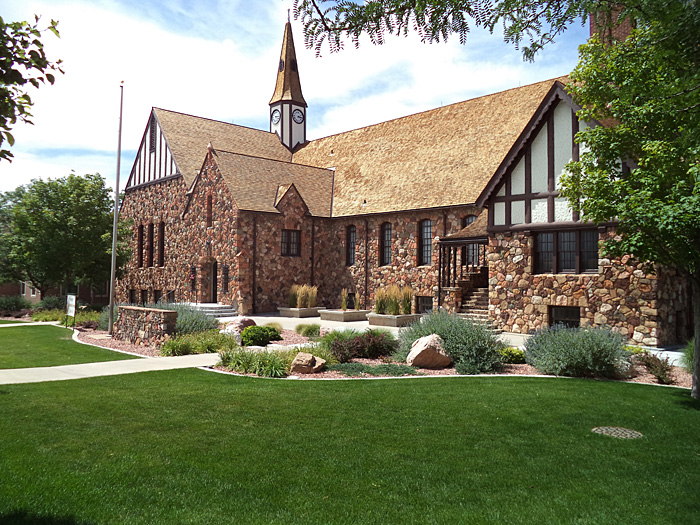
Cedar City Tabernacle - a beautiful structure.
July 20 - Sunday. Hurricane UT to Richfield UT.
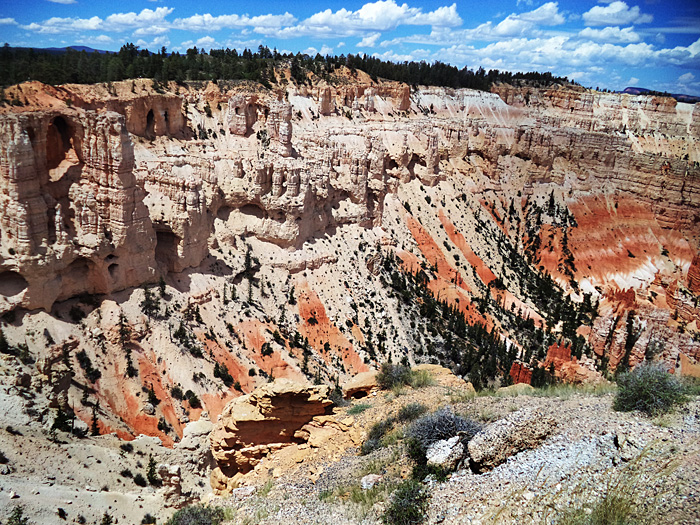
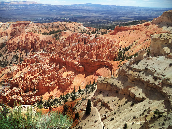
BRYCE CANYON National Park
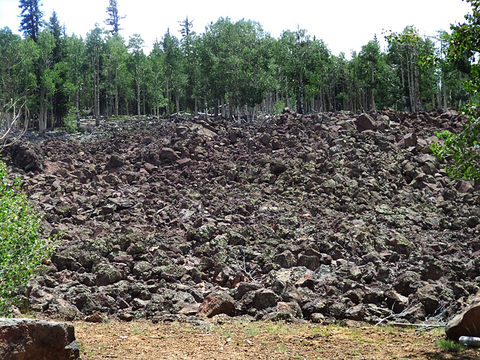
I repeated yesterday's drive in reverse direction to Cedar City, then Rt 14 to Rt 89, Through Duck Creek and past the fields of black rocks and entered BRYCE CANYON NP after driving through the spectacular Red Canyon near its entrance. Bryce Canyon NP features pure air, night sky views uncluttered by nearby light sources, over 56 square miles of inspirational beauty and views up to 200 miles distant encompassing 3 states. Words, and even photo fail to describe its many features and raw beauty.
After visiting the awesome and spectacularly beautiful Main Amphitheater I rode the park's Rt. 63 to Bryce Pt. where I hiked some of the Under-The-Rim trail. It was hot and dry - 100 degrees in the shade. After the hike I stopped at various "outlooks" and points of interest before heading back to the visitor center for some pizza and soda. I left Bryce and headed north on Rt. 89 - a highway loaded with spectacular mountain scenery.
NEAR DISASTER. A brief shower wet the interstate south of Richfield UT and then I saw I was headed into a thunderstorm - black sky and lightning - and decided to exit and take shelter in a car wash to wait out the storm. There was a cattle guard near the end of the exit ramp and when the bike ran across it, it spun out on the slick wet steel. Somehow, I know not how, I managed to keep the bike upright and made it to the carwash just as another biker joined me. He saw the whole thing and was amazed that I didn't dump it. (so was I!) At the carwash we found a backpack. The owner, a homeless man, was at the nearby C-store. I gave him his backpack and some money and headed out as the roads dried. I was extremely cautious crossing the cattle guard on the entrance ramp as I resumed travel on I 70. I stayed in a Motel 6, did some Walmart shopping and dined at Wendy's in Richfield UT.
Fields of black rock chunks, one of several. (Mysterious to me.)
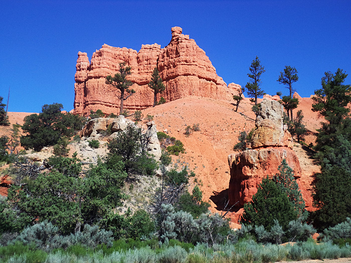
Red Canyon Rt. 12, Utah near Bryce Canyon entrance.
Red Canyon Rt. 12, Utah near Bryce Canyon entrance.
Bryce Canyon main amphitheatre
Hikers headed into Bryce Canyon on one of its many trails.
Near Under-The-Rim trailhead - Bryce Canyon NP
Edge of Bryce Canyon - ongoing gradual erosion of rock and sediment form hoodoos, fins and canyon features.
Many varied landscapes are found n in Bryce Canyon. Note trail bottom center
July 21 - Monday
FABULOUS Interstate 70 Richfield UT to Granby CO.
I vote Interstate 70 between southwest Utah and Denver Colorado as America's most beautiful and interesting interstate highway. It was very light traffic, few trucks. It provided never-ending scenery and points of interest - colorful buttes and hoodoos , along rivers and streams, through canyons, mountain and wilderness views, high mountain passes, and quaint villages and cities. It crosses the continental divide in Colorado with a tunnel underneath the 11,990 foot Loveland Pass, takes you through Grand Junction and Vail. Roadside rest areas and pull-offs are scenic wonders.
I am hoping to ride I 70 on 2015's western trip.
Just past Georgetown I exited I 70 and headed north on CO 40., a steep, curvy, switchback and hairpin turn-laden and exhilarating mountain road surrounded by snow capped peaks. It must have been made with motorcycles in mind - oh what a ride! Fun and beautiful. I was lucky to find a motel in Granby, although it was certainly nothing fancy. Adventuresome, I had Rocky Mountain Oysters (Fried bull testicles) in a nearby restaurant. I found them to be densely textured with a crisp coating, and flavored something between veal and liver. This restaurant suggested trying tartar sauce or their teriyaki sauce on them and that made them more interesting but covered up their natural flavor. As I said - it was adventuresome - but I'd have them again if the opportunity arose. There must be myriads of ways to cook and prepare them.
I 70 rest area view
I 70 rest area view - highway seen in upper right of picture.
I 70 rest area view - one of many colorful buttes.
July 22 Tuesday - Granby Co to Denver to Colby Kansas.
ROCKY MOUNTAIN NATIONAL PARK.
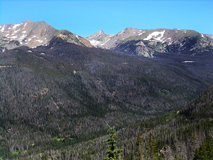
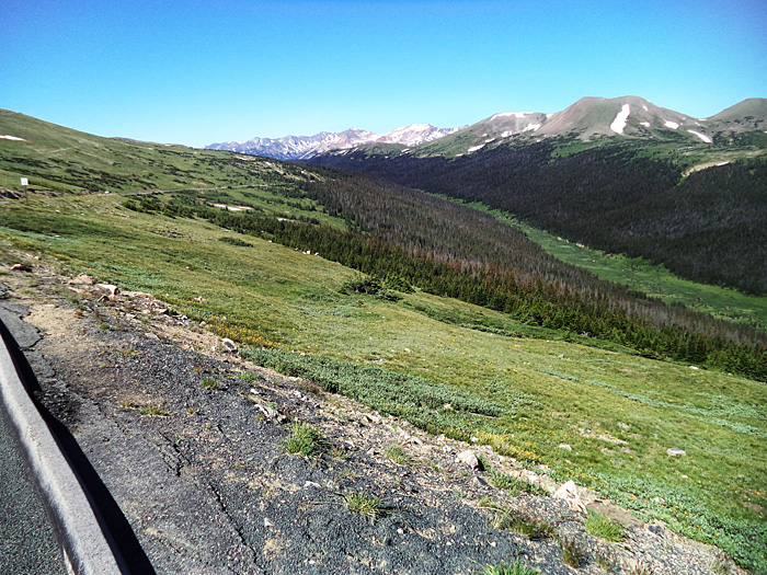
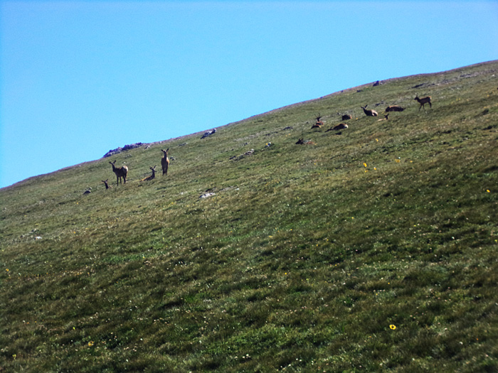
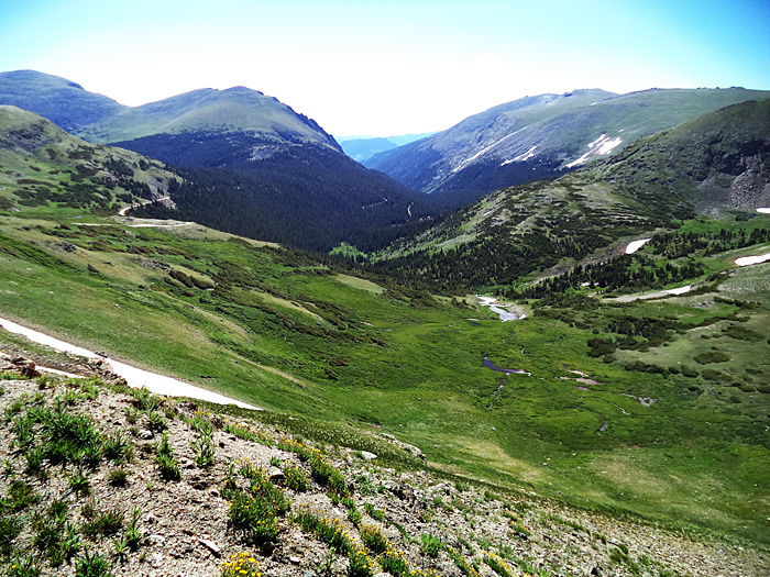
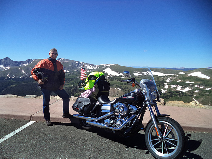
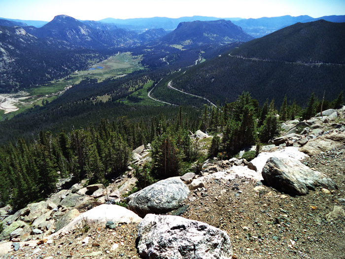
This will be my third visit to this splendid park. It continues to fascinate and awe me with its snow capped mountain peaks, beautiful meadows and abundant wildlife - not to mention the fabulous switchback mountain roads getting to and inside the park. It is just an indescribably beautiful place. The road goes over 12,000 feet elevation and is very chilly, even in July. Every time I have visited this park I've seen herds of elk and often other wild sheep, deer and marmots. A large herd was grazing on a steep grass covered hillside not far from the park's main road. I have never driven through the park from east (Denver) to west and I may try that next year as I ride I 70 from east to west also.
Descending the road from the park toward Denver I wanted to stay in the mountains so I took 36 to Lyons then 7W toward Boulder, then meandered back roads to I 25 and south through horrendous Denver traffic, back onto I 70 to Colby Kansas.
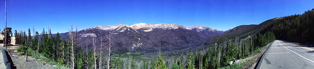
Panoramic view of mountains on Rt 40. Motorcycle heaven.
Snowy mountains southwest of Rocky Mtn NP.
West entrance road and mountains Rocky Mt. NP
Elk graze and lounge on a sunny hillside meadow along the park road.
Meadow and mountain view - Rocky Mtn. NP
Harley Low Rider at 12,000 feet elevation - RMNP. It's all down hill to home from here.
Eastern entrance switchback road scenes RMNP -
July 23 Weds. Colby KS to Concordia MO.
The western adventure and sightseeing part of my Journey to Angel's landing is now mostly over and it is a matter of getting home safely. The speed limit on the interstate in Kansas is 70 MPH. There is not a lot of spectacular scenery in Kansas - it's pretty flat with miles upon miles of large open farmland. Kansas tries to get your attention and tourist dollar with myriad museum offerings and there's even a greyhound petting park. I would suggest they have a windmill farm exhibit where people could see the gigantic monsters up close and operating. My stay at a nearby motel chain (inn) was most disappointing. It was a bit run down and the breakfast was abysmal - no eggs or meat, out of juice, out of milk, no waffles, only two cereals but lots of obnoxious kids. Dined at a nearby Pizza Hut and they didn't even have beer. Hard to fathom.
July 24 Thursday. Concordia MO to Greenfield Indiana
Missouri speed limit is 70 MPH on the Interstate. I found lots of construction on I 70 as I went through and around Topeka KS and Kansas City MO, through the center of Indiana, around Indianapolis there was a major delay caused by a big rig wreck and more construction.

July 25 Friday Greenfield Indiana to Ebensburg PA.
I stayed on I 70 until i got south of Pittsburg PA, then picked up US22/119. It was an error in routing - lots of small (slow) towns, heavy truck traffic and hills - very slow travelling overall. Not pleasant. I continued until tired and took a motel at Ebensburg.
July 26 Saturday Ebensburg via Altoona and State College, Williamsport - then Home.
Cloudy and cool, some showers made it cold. Stopped in Dushore on Rt 220 to warm up before pushing on home.
Always glad to be back home. 5,697 miles is a long journey on a motorcycle.
Map Of Trip
www.awrobbins.com Website by John M Clum